In January 48 BC, Julius Caesar crossed the Adriatic Sea from Brundisium (modern Brindisi, Italy) with seven legions and landed on the coast of Epirus to confront his rival Pompey in the Roman Civil War. According to ancient sources, his landing point was Palaeste — identified with modern-day Palasa, a small coastal village on the Albanian Riviera just below Llogara Pass.
Today, you can hike Caesar's Trail — a 2.4 km path from Llogara National Park down to the Palasa Stream Delta — and walk roughly the same route Caesar's legions took after making landfall. It is one of the few places on the Albanian Riviera where ancient history, dramatic landscape, and an easy hike converge into a single experience.
Compare hotels, apartments, and Vrbo rentals on the map. Powered by Stay22.
Quick Facts
| Detail | Info |
|---|---|
| Historical event | Caesar's landing during the Roman Civil War |
| Date | January 48 BC |
| Ancient name | Palaeste (meaning "shallow water") |
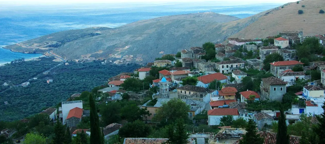
| Modern location | Palasa village, Himara municipality |
| Caesar's Trail length | ~2.4 km |
| Trail difficulty | Easy–moderate (downhill from Llogara) |
| Trail high point | ~950 meters |
| Time | 30–45 minutes (one way) |
| Cost | Free |
The History: Caesar's Crossing
Why Albania?
By 49 BC, the Roman Republic had split. Caesar controlled Italy and the western provinces. Pompey had retreated east with the Roman Senate and much of the army, establishing his base in Greece and the Balkans. To end the civil war, Caesar had to cross the Adriatic and confront Pompey on his own ground.
The coast of Epirus — the stretch of Albanian and Greek coastline along the Ionian Sea — was Pompey's territory. Landing there was a strategic gamble: Caesar's fleet was smaller than Pompey's, and a winter crossing of the Adriatic was extremely dangerous.
The Landing at Palaeste (January 48 BC)
Caesar departed Brundisium on January 4, 48 BC with seven understrength legions — roughly 15,000–20,000 men plus around 500 cavalry — and crossed the Adriatic in winter, evading Pompey's naval patrols. He landed at Palaeste, a small harbor whose name meant "shallow water" in the local language — exactly the kind of coastline that could accommodate a mass disembarkation of troops and supplies.
From the beach, Caesar needed to move his army quickly inland before Pompey could respond. The route over the Acroceraunian Mountains — the dramatic coastal range that includes modern Llogara Pass at 1,027 meters — was his path north toward Dyrrhachium (modern Durrës), where Pompey's forces were concentrated.
After the Landing
The campaign that followed was complex and brutal. Caesar marched north along the coast, eventually besieging Pompey at Dyrrhachium before the decisive Battle of Pharsalus in August 48 BC — one of the most famous battles in ancient history, fought in central Greece, where Caesar defeated Pompey decisively.
But it all began on a beach below the mountains of the Albanian Riviera.
A Note on Location
Scholars have debated the exact identification of Palaeste. The traditional view — widely accepted and reflected in local Albanian signage and tourism — identifies it with modern Palasa, based on the name similarity and the geographic description in ancient sources. Some academics have suggested the landing may have occurred further north, inside the Gulf of Vlora. The Palasa identification remains the most commonly cited.
Caesar's Trail: Hiking Guide
Overview
The "In the Footsteps of Caesar" trail (Albanian: Shtegu i Cezarit) is a marked hiking path from Llogara National Park down to the Palasa Stream Delta — roughly following the route Caesar's forces would have taken after landing to cross the mountains.
| Detail | Info |
|---|---|
| Start | Llogara National Park (near Caesar's Pass viewpoint) |
| End | Palasa Stream Delta |
| Distance | ~2.4 km |
| Elevation | From ~950m down to sea level |
| Direction | Downhill (Llogara → Palasa) |
| Difficulty | Easy–moderate |
| Time | 30–45 minutes (one way, downhill) |
| Return | Walk back uphill (~1 hour) or arrange car pickup at Palasa |
The Trail
The path begins near the Caesar's Pass viewpoint in Llogara National Park, at roughly 950 meters elevation. From here, it descends through pine forest and mountain scrub with views expanding over the Ionian coast as you drop in elevation.
The trail is marked but not heavily maintained — sturdy shoes are recommended. The final stretch reaches the Palasa Stream Delta, a designated natural monument where the mountain stream meets the sea.
Views along the way: The Acroceraunian Mountains dropping into the Ionian, the coastline stretching south toward Dhermi and Himara, and on clear days, the island of Corfu.
Getting to the Trailhead
By car: Drive over Llogara Pass from either direction. The Caesar's Pass viewpoint is marked with signage along the main road through Llogara National Park. Park at the viewpoint or at one of the restaurants along the pass road.
From Himara: Drive north on SH8 through Dhermi and up to Llogara Pass — roughly 30–40 minutes (25 km).
From Vlora: Drive south on SH8 over Llogara Pass — roughly 40 minutes (40 km).
Logistics Tip
The trail is one-way downhill. You have three options for the return:
- Walk back uphill — ~1 hour, moderate effort
- Arrange a pickup at Palasa (taxi or travel companion with car)
- Start from Palasa and hike up — harder but means your car is waiting at the top
What to See at Palasa
After the hike (or as a standalone visit), modern Palasa offers:
Palasa Beach — A long pebble beach below the mountains with clear Ionian water. The Green Coast resort has brought development to the area, but the beach remains scenic. Sunbeds are available in summer.
Archaeological remains — Scattered remnants from the 2nd century BC are found in the area, though not formally excavated or displayed. These date to the Roman period following Caesar's campaign.
Grama Bay inscriptions — Nearby Grama Bay (accessible by boat tour) contains ancient sailors' inscriptions carved into coastal cliffs — graffiti spanning centuries of maritime history.
Palasa Stream Delta — A designated natural monument at the trail's endpoint, where the mountain stream creates a small wetland ecosystem before meeting the sea.
Caesar's Trail vs Other Riviera Hikes
| Trail | Distance | Difficulty | Historical Interest | Views |
|---|---|---|---|---|
| Caesar's Trail | 2.4 km | Easy–moderate | Roman Civil War landing | Mountain to sea panorama |
| Gjipe Canyon | ~2 km | Moderate | None | Canyon + beach |
| Athali Monastery | ~5 km RT | Moderate–hard | Byzantine monastery | Ionian panorama |
| Borsh Castle | ~1.3 km | Moderate | 3,000-year fortress | Beach + mountain views |
Caesar's Trail is the easiest of these hikes and the only one with direct ancient Roman historical significance.
Combining with Llogara Pass
The trail starts at Llogara Pass, one of the most scenic drives on the Albanian Riviera. A natural half-day itinerary:
- Drive to Llogara Pass — stop at the viewpoints (1,027m elevation)
- Hike Caesar's Trail down to Palasa (30–45 min)
- Swim at Palasa Beach
- Return uphill or drive down to Dhermi for the afternoon
For the full Llogara experience — including the flag pines, mountain restaurants, and paragliding launch sites — see our Llogara Pass guide.
When to Visit
Best months: April–June and September–November. The trail is exposed to sun on the lower sections, making summer descents hot. Spring and autumn offer comfortable temperatures and clear views.
Best time of day: Morning. Hike down in cool air, reach the beach by late morning.
Time needed: Allow 2–3 hours for the full experience — drive to Llogara, hike down, explore Palasa, return.
Practical Tips
- Wear sturdy shoes — The trail is uneven in places with loose stones
- Bring water — No facilities on the trail itself
- Sun protection — Lower sections have limited shade
- Car logistics — Plan your return method before starting. Walking back uphill takes roughly double the descent time
- Llogara restaurants — Several mountain restaurants at the pass serve traditional Albanian food. Eat before or after the hike
- History buffs — Bring a copy of Caesar's De Bello Civili (Civil War commentaries) for the full experience. Book III describes the Adriatic crossing and Epirus campaign
FAQ
Did Julius Caesar really land at Palasa?
Ancient sources describe Caesar landing at "Palaeste" on the coast of Epirus in January 48 BC. The traditional identification with modern Palasa is based on the name similarity and geographic match. Some scholars have proposed alternative landing sites further north in the Gulf of Vlora, but Palasa remains the most widely accepted identification and is the one reflected in local Albanian heritage signage.
How hard is Caesar's Trail?
Easy to moderate. The trail is 2.4 km, mostly downhill from Llogara National Park (~950m) to the coast. It takes 30–45 minutes descending. The return hike uphill is harder — roughly 1 hour with significant elevation gain. The path is marked but not paved, so sturdy shoes are recommended.
Can I drive to Palasa instead of hiking?
Yes. The SH8 road descends from Llogara Pass through a series of switchbacks to the coast, passing through Palasa village. You can drive directly to the beach. The hike is optional — it simply offers a more immersive route and follows the historical path.
What else is at Llogara Pass?
Llogara Pass at 1,027 meters is one of Albania's most scenic drives. Features include flag pines (trees shaped by constant wind), paragliding launch sites, mountain restaurants, and panoramic viewpoints over the entire Albanian Riviera. Caesar's Trail is one of several hiking options in the national park.
Is Palasa worth visiting without doing the hike?
Yes. Palasa Beach is a scenic Riviera destination in its own right — clear water, mountain backdrop, and a developing resort scene. The historical connection to Caesar adds an interesting layer, but the beach stands on its own merits.