Hiking near Himara is the best way to see the parts of the Albanian Riviera that most visitors never reach. The coastline south of Llogara Pass is cut by limestone canyons, dotted with hidden coves accessible only on foot, and backed by the Ceraunian Mountains rising to over 2,000 meters. Trails range from flat 20-minute walks to pristine beaches to full-day mountain traverses with views stretching to Italy. Whether you want a casual morning stroll to a snorkeling cove or a serious summit push, there's a trail within 30 minutes of town. Most are free, unmarked on Google Maps, and empty compared to anything you'd find on a Greek island.
Compare hotels, apartments, and Vrbo rentals on the map. Powered by Stay22.
Book tours & activities: Compare guided day trips, boat tours, and excursions on GetYourGuide.
Trail Overview
| Trail | Distance | Time | Difficulty | Highlight |
|---|---|---|---|---|
| Gjipe Canyon Trail | 2.5 km one way | 30 min | Easy | Canyon narrows to turquoise beach |
| Livadhi to Akuarium Beach | 1.5 km one way | 30-40 min | Moderate | Hidden crystal-clear cove |
| Himara to Filikuri Beach | ~1.5 km one way | 20-30 min | Easy-Moderate | Pristine snorkeling spot |
| Vuno to Himara Coastal Trail | ~8 km one way | 3-4 hrs | Moderate | Cliff paths, Mediterranean macchia |
| Dhermi to Gjipe Coastal Walk | ~10 km one way | 3 hrs | Moderate | Full southern coastal traverse |
| Caesar's Trail (Llogara) | 2.4 km one way | ~1 hr | Easy | Ridge walk at 950 m with sea views |
| Mount Cika Summit | 12 km round trip | 6-8 hrs | Strenuous | 2,044 m peak, panoramic summit |
| Llogara Viewpoint Loop | ~1 km loop | 30 min | Easy | Family-friendly forest loop |
| Flag Pines Trail | ~0.5 km round trip | 15-20 min | Easy | Wind-sculpted ancient pines |
| Himara to Pilur Village | 6.5 km one way | 2-2.5 hrs | Hard | 700 m gain to mountain village |
| Kudhes to Qeparo Loop | 12 km loop | ~4 hrs | Moderate | Shepherd paths, Corfu views |
| Ceraunian Grand Traverse | ~22 km one way | 8-10 hrs | Strenuous | Full mountain crossing, GPS required |
Coastal Walks
These are the trails most visitors should start with. They connect beaches, follow cliff edges, and require nothing more than decent shoes and water.
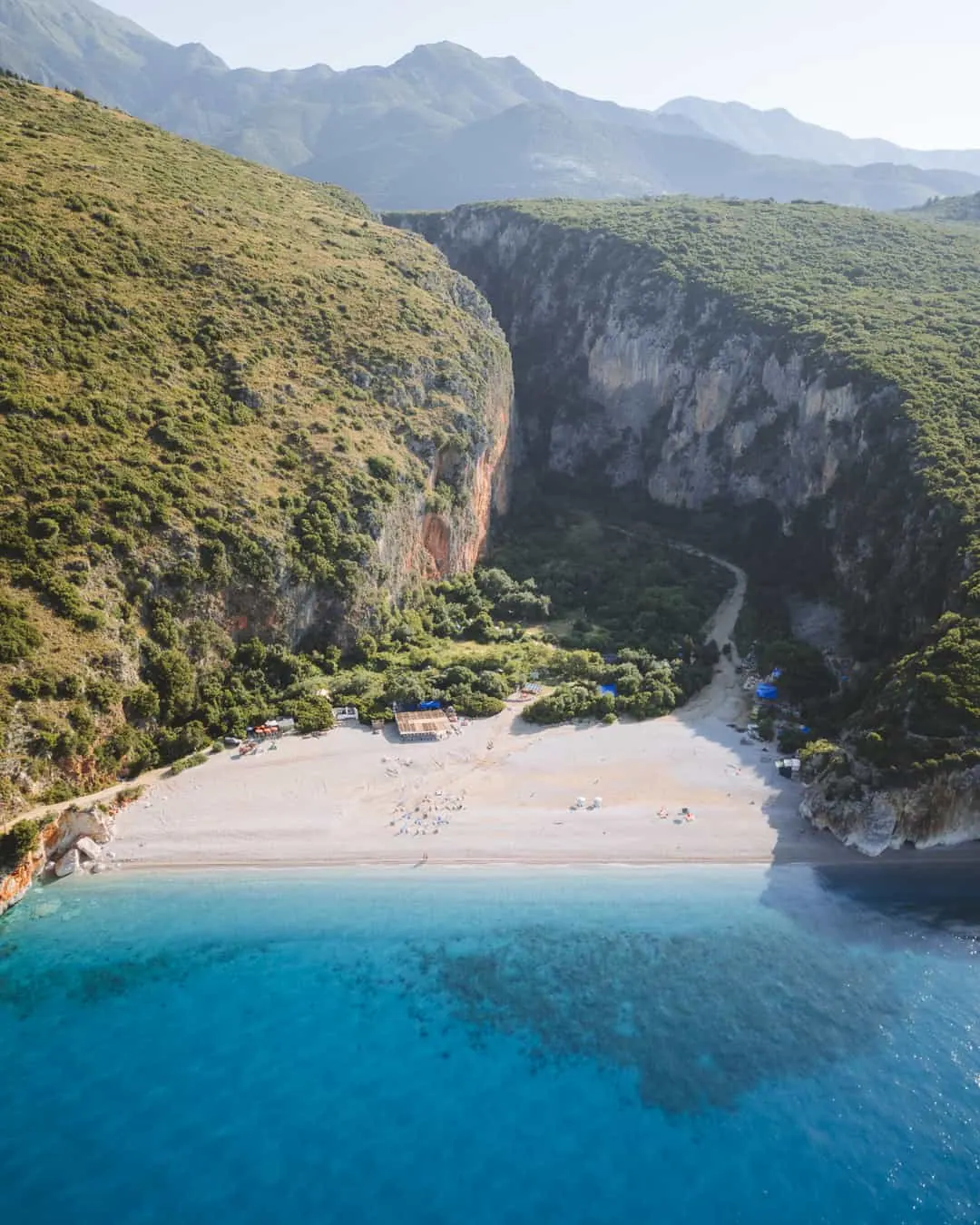
Gjipe Canyon Trail
The most popular hike near Himara and arguably the most dramatic short walk on the Albanian Riviera. You park at the trailhead above the canyon (400 ALL for parking), then walk about 2.5 km down through scrubby hillside before the path drops into the canyon itself. The final stretch narrows between vertical limestone walls, and then the canyon opens to Gjipe Beach -- a pebble-sand cove framed by cliffs on both sides.
The walk takes 30 minutes down, 45 minutes back up. It's exposed and hot in summer, so go before 10 AM or after 4 PM. There's no shade until you enter the canyon. At the beach, a few seasonal vendors sell drinks and rent umbrellas, but facilities are minimal. The canyon extends inland beyond the beach and is worth exploring on foot for another 15-20 minutes if you're curious.
This trail is also the final section of the longer Dhermi-to-Gjipe coastal walk (see below). You can combine both or just do the canyon portion as a standalone.
Himara to Filikuri Beach
Filikuri Beach is one of the Riviera's best-kept secrets -- a small rocky cove with absurdly clear water and excellent snorkeling. The hike from Himara takes 20-30 minutes along a dirt path that heads south from town, skirting the coast above the cliffs. The trail is not formally marked but well-worn enough to follow.
The descent to the beach is steep in the final stretch. Wear shoes with grip, not flip-flops. Once you're down, the cove is sheltered and calm on most days. Bring a mask and snorkel -- the underwater visibility here is some of the best on the coast, with rocky formations close to shore that attract small fish. There are no facilities at Filikuri, so carry everything you need.
Livadhi to Akuarium Beach
From the south end of Livadhi Beach, a marked trail (red blazes on rocks) climbs over a rocky headland and descends to Akuarium Beach -- a tiny cove named for its crystal-clear water. The hike is 1.5 km and takes about 30-40 minutes. It's rated moderate because the trail crosses some exposed rocky sections with mild scrambling.
Akuarium is small enough that 10-15 people fill it. Go early to have it to yourself. The water is shallow near shore and deepens quickly, with excellent visibility. No shade, no vendors, no facilities. This is one of the best short hikes near Himara for the effort-to-reward ratio.
Dhermi to Jale to Gjipe Coastal Walk
This is the signature coastal hike of the Albanian Riviera. Starting in Dhermi, the trail follows the coast south through Jale Beach and ends at Gjipe Beach -- roughly 10 km, 3 hours of walking. Red-and-white trail markings guide you along cliff edges, through Mediterranean macchia scrub, past hidden coves, and over rocky headlands with constant Ionian views.
The trail is part of the larger Southern Coastal Trail network. It's not technical, but it's exposed to sun for most of the route, and some sections cross loose rock above steep drops. Sturdy shoes are essential. Bring at least 2 liters of water per person.
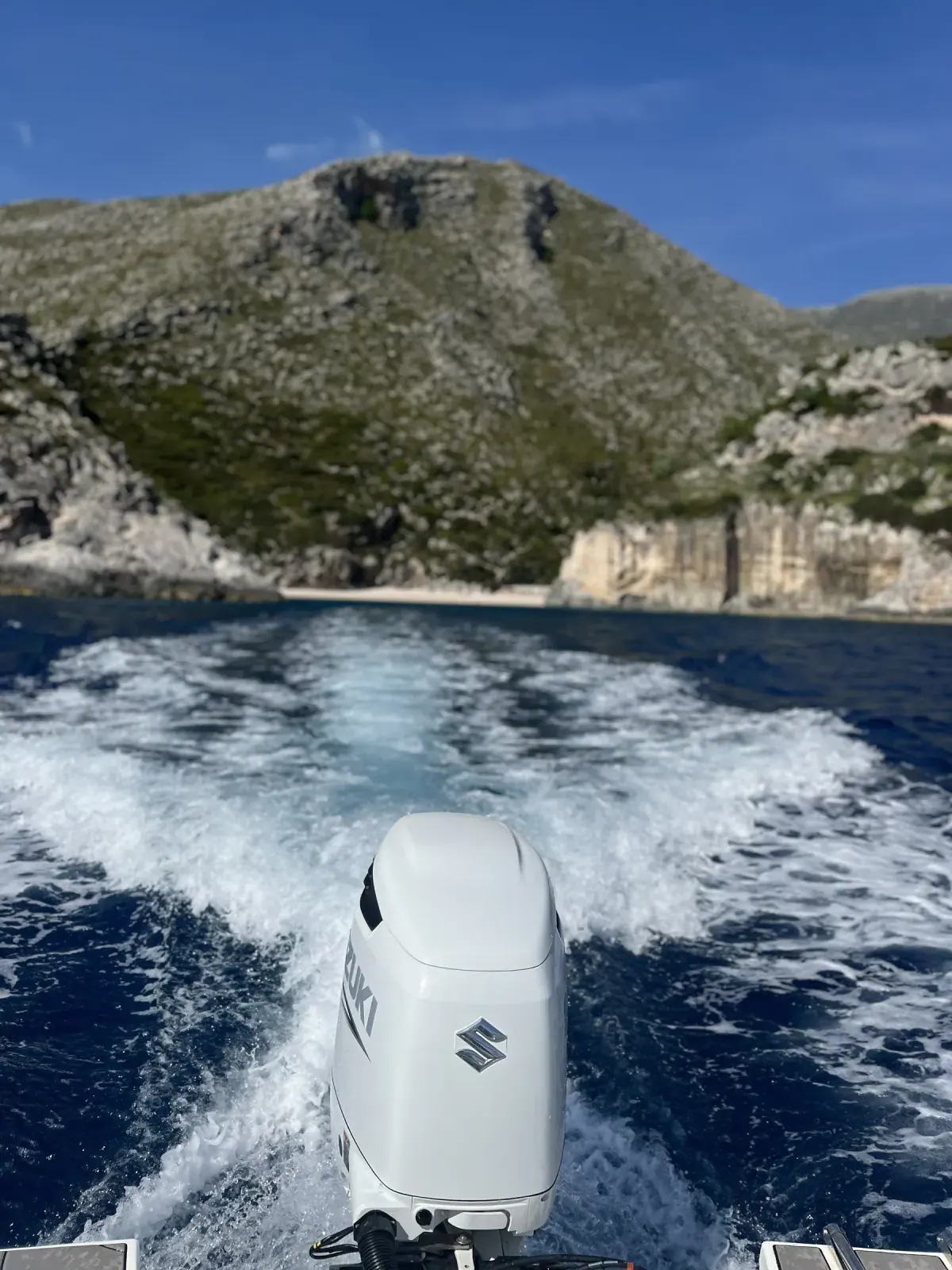
The best approach: start in Dhermi in the morning, hike south to Gjipe, swim at the beach, then catch a boat taxi back to Himara (roughly 15-20€) instead of hiking back the same way. This turns a long out-and-back into a satisfying point-to-point day. For more on the beaches along this route, see the best beaches guide.
Vuno to Himara Coastal Trail
Another section of the Southern Coastal Trail, this route connects the hillside village of Vuno to Himara, passing through Akuarium Beach along the way. The full trail is roughly 8 km and takes 3-4 hours. Red-and-white blazes mark the route, which crosses cliffs above the sea, passes through dense macchia, and offers some of the best elevated views of the Ionian coast.
The trail is mostly moderate, with a few sections that require careful footing on rocky terrain. Vuno itself is worth 30 minutes of exploring -- it's a traditional stone village clinging to a hillside, largely untouched by tourism. You can arrange a taxi from Himara to Vuno (about 1,500 ALL) and hike back south, finishing in town.
Llogara National Park Trails
Llogara sits 25 minutes north of Himara by car, at roughly 1,000 meters elevation. The temperature is 10-15 degrees cooler than the coast, the forest is dense alpine pine, and the hiking ranges from flat strolls to a serious mountain summit. For driving directions and what else to do at the pass, see the Llogara Pass guide.
Flag Pines Trail
The shortest and easiest walk in Llogara: a flat 15-20 minute round trip from the road to a grove of ancient Bosnian pines sculpted by decades of Ionian wind into permanent horizontal lean. The trees are striking and unique to this microclimate. Photography works best in morning light. Suitable for anyone, including small children.
Llogara Viewpoint Loop
A 30-minute loop through pine forest to a cleared overlook facing south toward the Riviera coast. Starts behind the main restaurant cluster at the Llogara summit. Flat terrain, easy footing, family-friendly. The view from the overlook takes in Dhermi, Drymades, and the coast stretching toward Himara -- on a clear day, you can see Corfu.
Caesar's Trail
Named for Julius Caesar's reported crossing of the Ceraunian Mountains in 48 BC, this trail follows the ridge south from the Llogara Pass summit. It's 2.4 km one way, about an hour of walking, and rated easy. The trailhead sits at roughly 950 meters elevation, and the path stays high along the ridgeline with continuous views down to the coast on one side and inland mountains on the other.
The trail connects Llogara National Park to the Palasa Stream Delta. It's well-suited to anyone who wants a real hike without serious elevation gain. The views alone justify the drive up to Llogara even if you do nothing else.
Mount Cika Summit
This is the big one. Mount Cika is the highest peak in the Ceraunian range at 2,044 meters, and reaching the summit is a proper mountain hike -- not a casual walk. The round trip is 12 km with approximately 1,017 meters of elevation gain from the Llogara Pass trailhead near the Panorama Restaurant. Budget 6-8 hours for the full ascent and descent.
The trail is reasonably clear through the forest zone but becomes faint and poorly marked above the treeline. Cairns help, but navigation can be tricky in cloud or fog. Carry a GPS device or phone with downloaded offline maps. The summit views are extraordinary in clear weather: the entire Riviera from Vlore to Saranda, the island of Corfu, and on exceptional days, the coast of Italy.
What you need: Hiking boots (not sneakers), 3+ liters of water, food, sun protection, a wind layer for the summit, and an early start (leave by 7 AM at the latest). This is not a trail to attempt in afternoon heat or without proper gear. Check conditions locally before going -- mountain weather changes fast at altitude.
Mountain & Village Trails
These trails head inland, away from the coast and into the Ceraunian Mountains. They're quieter, more rugged, and give a completely different perspective on the region.
Himara to Pilur Village
Pilur is a small mountain village perched at about 700 meters above Himara. The trail to reach it is 6.5 km with 700 meters of elevation gain -- steep, sustained, and exposed in sections. White-red-white trail markings guide the route, and the hike takes 2 to 2.5 hours going up. The descent is faster but hard on the knees.
Pilur itself is a quiet stone village with a handful of permanent residents, a church, and sweeping views of the coast below. It's a window into the mountain life that still exists above the tourist beaches. Bring water and snacks -- there are no shops or cafes in the village.
Kudhes to Qeparo Shepherd's Trail
A 12-km loop trail that follows old shepherd paths between the villages of Kudhes and Qeparo, through terraced agricultural fields and rocky hillside pastures. Elevation gain is roughly 425 meters up and 425 meters down. The loop takes about 4 hours at a steady pace.
The trail passes through landscapes that haven't changed much in centuries: stone walls dividing grazing land, abandoned terraces where olives and figs still grow wild, and open ridgelines with views south to the Greek island of Corfu. This is one of the best hikes near Himara for anyone who wants to see the inland side of the Riviera without committing to a full mountain day. The path is rocky in places but not technical.
Ceraunian Mountains Grand Traverse
The most ambitious hike in the region: a roughly 22-km traverse from Llogara Pass to Pilur Village along the spine of the Ceraunian Mountains. This is a full-day, strenuous undertaking. Markings are poor to nonexistent in sections, and GPS navigation is required. The terrain above the treeline is exposed, rocky, and remote.
On clear days, the views are staggering -- the entire Albanian Riviera spread below you, the Ionian Sea, Corfu, and reportedly the Italian coast on the horizon. But this is a serious mountain route. You need proper hiking boots, navigation tools, plenty of water and food, weather awareness, and ideally a hiking partner. Don't attempt it without preparation or in uncertain weather.
For context on how this route connects to the broader area, see our day trips from Himara guide.
Trail Comparison: Which Hike Is Right for You?
| If you want... | Do this trail | Why |
|---|---|---|
| Best short hike | Gjipe Canyon Trail | 30 min to the most dramatic beach on the coast |
| Best snorkeling access | Himara to Filikuri | Quick walk to the clearest water near town |
| Best half-day walk | Dhermi to Gjipe Coastal | 3 hrs of cliff-edge Ionian views |
| Best family hike | Llogara Viewpoint Loop | 30 min, flat, shaded, great views |
| Best mountain challenge | Mount Cika Summit | 2,044 m summit, 6-8 hr round trip |
| Best cultural experience | Himara to Pilur Village | Mountain village life above the coast |
| Best multi-day potential | Ceraunian Grand Traverse | Full mountain crossing, serious adventure |
| Best photography | Flag Pines Trail | Wind-sculpted ancient pines, 15 min walk |
Practical Tips
When to Hike
May through October is hiking season. June and September are ideal -- warm enough for coastal swims at trail's end, cool enough that the exposed sections aren't brutal. July and August work but the heat on shadeless coastal trails is intense. Start early (before 9 AM) in summer, or go late afternoon.
For mountain trails (Cika, Grand Traverse, Pilur), conditions are best from June through September. Snow can linger on north-facing slopes above 1,500 meters into May, and early autumn storms can hit the ridgeline without much warning.
What to Bring
Every hike, no matter how short: water (minimum 1.5 liters in summer), sun protection, and shoes with grip. Flip-flops on rocky coastal trails are how people get injured.
For mountain hikes: hiking boots, 3+ liters of water, food, a wind/rain layer, offline maps (Maps.me or downloaded Google Maps), and a fully charged phone. Cell service is unreliable above the coast and nonexistent on mountain ridgelines.
Trail Markings
Coastal trails generally follow red-and-white or red blaze markings painted on rocks. They're adequate but not continuous -- you'll sometimes need to use judgment at forks. Mountain trails above the treeline are poorly marked or unmarked. GPS is essential for the Cika summit and Grand Traverse.
Maps.me has the best trail coverage for this area. Download the Albania offline map before you arrive.
Water and Facilities
There are no water sources, toilets, or facilities on any trail listed here except at developed beach endpoints during summer. Carry everything you need. The mountain restaurants at Llogara Pass are the exception -- they're open roughly May through October and serve food and drinks.
Getting to Trailheads
Most coastal trailheads are accessible by car or scooter from Himara. The Gjipe Canyon trailhead is 25 minutes north by car. Llogara trailheads are 25 minutes north. Vuno is accessible by taxi. For getting around generally, see our activities page for transport options.
Frequently Asked Questions
Are hiking trails near Himara well-marked?
Coastal trails have red-and-white blazes that are mostly reliable, though gaps exist at junctions. Mountain trails above the treeline are poorly marked or unmarked entirely. Download offline maps on Maps.me before you go -- it has the most complete trail data for this area.
Do I need hiking boots for trails near Himara?
For coastal walks like Gjipe Canyon, Filikuri, and Akuarium, sturdy sandals or trail shoes with grip are fine. For anything in Llogara or the mountains -- especially Mount Cika, Pilur, or the Grand Traverse -- proper hiking boots are essential. The terrain is rocky and loose above the treeline.
Can I hike year-round near Himara?
Coastal trails are walkable year-round, though winter rain can make them muddy and slippery. Mountain trails are seasonal: June through September is the reliable window. Snow and ice can make routes above 1,500 meters dangerous outside that range. Llogara Pass trails are accessible from May to October in most years.
Is Gjipe Canyon suitable for children?
The walk down to Gjipe Beach is manageable for children over about 6 or 7 who are comfortable walking on uneven terrain. The trail is not technical but it is exposed to sun and the final descent is steep. Carry extra water and go early. For younger children, the Llogara Viewpoint Loop or Flag Pines Trail are better options.
Are there guided hiking tours from Himara?
Local operators offer guided hikes, particularly for the Mount Cika summit and the Ceraunian Grand Traverse. These are worth considering if you're uncomfortable with navigation on unmarked mountain trails. Ask at your accommodation or check the activities page for current operators. You can also browse Albania hiking tours on GetYourGuide for fixed-price options with verified reviews. Coastal trails don't require a guide.