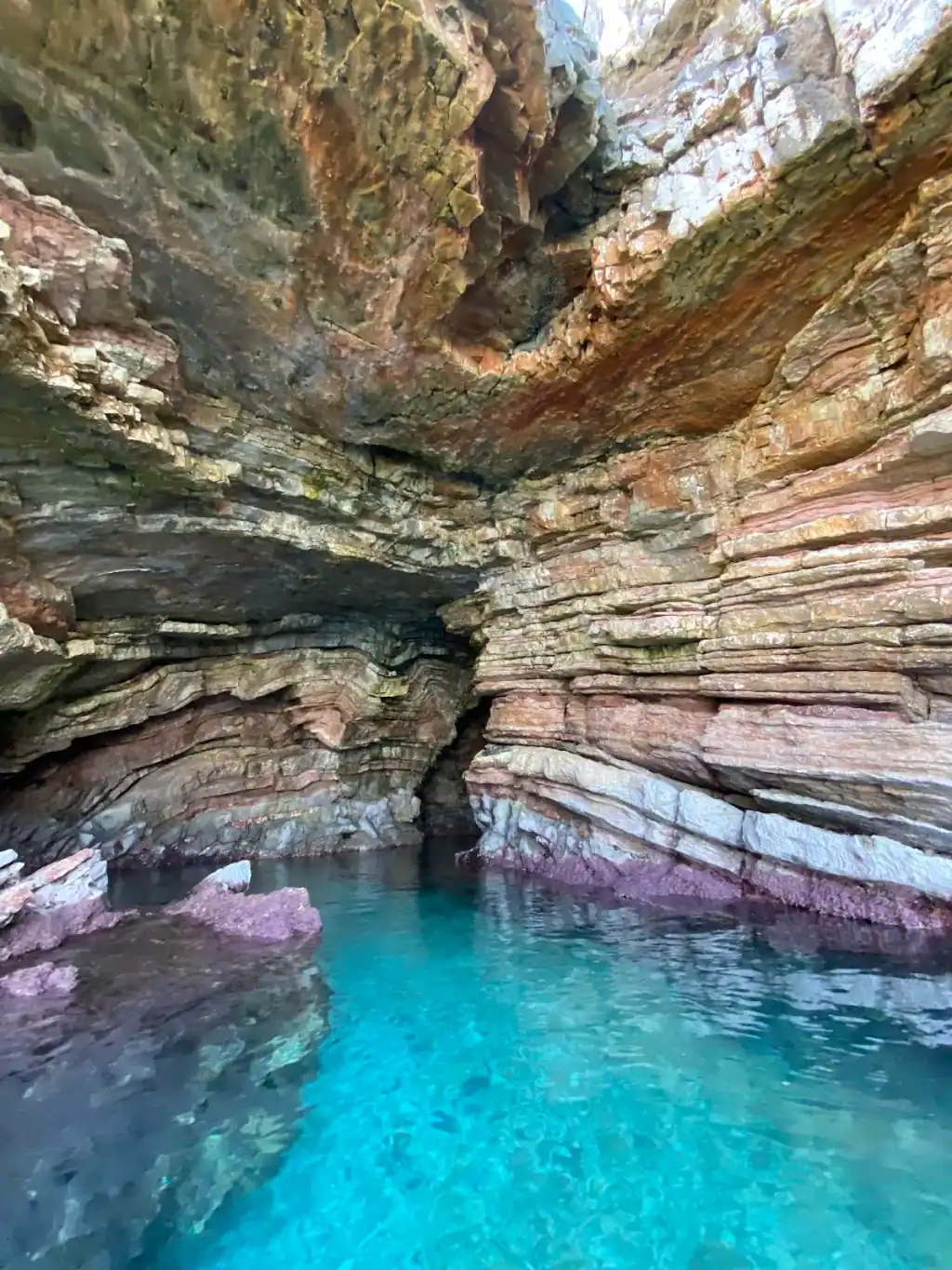
Inside Turtle's Cave near Saranda, layered pink and grey rock arching over bright turquoise water
cave

Turtle's Cave

Also: The Cave of Milot · Shpella e Breshkës · Turtle Cave · Shpella e Milotit

Direction from Himara
Southbound
Distance by sea
About 30 km south of Himara in a straight line; roughly 8 km north-west of Saranda
Swim stop
A photo stop of a few minutes; operators do not take boats inside
Access
By boat only, seen from the water

Turtle's Cave is the sea cave 8 km north-west of Saranda, listed on Google Maps as The Cave of Milot. A photo stop on the Saranda speedboat circuit, next to Anchor Bay.

What Turtle's Cave Is

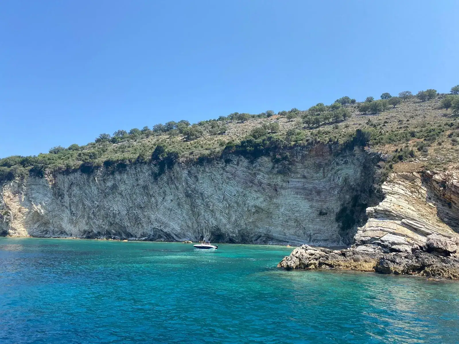
Turtle's Cave is a sea cave on the coast about 8 km north-west of Saranda, on the stretch the speedboat circuits run before they open out toward the Cape of Qefali. Inside, the rock is bedded in thin layers and stained pink, rust and grey, arching low over water that turns a hard turquoise where the floor comes up pale beneath it.

The name is not settled. Google Maps lists this pin as The Cave of Milot, rated 4.4 from 75 reviews. OpenStreetMap tags the same point, 25 m away, as Turtle Cave. Every Saranda operator board we have seen calls it Turtle's Cave. We have not found which name came first, so this page uses the one you will be sold and records the rest.

Seeing It

  • Operators run it as a photo stop of roughly five minutes, not a swim stop
  • Boats generally stay at the mouth rather than going in
  • The light reaches furthest into the chamber late in the morning
  • The colour comes from the shallow pale floor, so it reads best on a calm day

Anchor Bay, 270 m North

The next inlet up the coast is the one itineraries call Anchor Bay. Google has a listing there as Anchor Cave at 39.8898°N, 19.9569°E, rated 4.5 — the listing shows no review count, so we are not publishing one. OpenStreetMap maps the same point as Gjiri i Spirancës, and spirancë is Albanian for anchor, which is as close to a confirmation of the name as this coast gets. Tours that list both take them in one pass.

Where It Sits on the Circuit

Turtle's Cave is the Saranda end of the run. Heading out, boats take it first, then Gjiri i Rrojdhes, Soldier's Bay, Gremina on the Cape of Qefali, Kakome and the long stop at Kroreza. Some boards run the order the other way.

Getting There

By boat from Saranda. The circuits leave the promenade mid-morning and take four to six hours. There is no land access, and nothing to land on.

Comparing the boats? Our Saranda boat tours guide sets the group cruises, the speedboat circuits and the private charters against each other, with 2026 prices.

Water

Bright turquoise over a pale shallow floor, deepening at the mouth

Best Time

Late morning, when the light reaches into the chamber

Best For

PhotographySea-cave geology

Location on the Riviera

Typically Included In

  • Saranda speedboat circuits to Kakome and Kroreza
  • Private charters out of Saranda port

Boat tours that stop at Turtle's Cave

No fixed route lists Turtle's Cave as a scheduled stop.

Himara operators can add it to a private charter, or browse everything sailing from town.

Browse Himara boat tours

Frequently Asked Questions

Where is Turtle's Cave?+

At 39.8875°N, 19.9568°E, about 8 km north-west of Saranda on the run toward the Cape of Qefali. It is the first or last stop on most Saranda speedboat circuits, depending on which way the boat goes.

Why does Google Maps call it The Cave of Milot?+

Because the listing was created under that name. The same pin is tagged Turtle Cave in OpenStreetMap, and every Saranda operator sells it as Turtle's Cave or Shpella e Breshkës. One cave, three names — we could not find which came first.

Do boats go inside Turtle's Cave?+

Operators describe it as a photo and video stop of about five minutes with no swimming, so you see it from the deck. Whether a small boat noses in depends on the swell and the skipper.

Is there a turtle?+

The name is usually explained by a rock formation shaped like a shell, and sea turtles are occasionally seen on this coast. Neither claim has a source we could verify, so treat both as the story the boards tell.

What is Anchor Bay?+

The next inlet, about 270 m north. Google lists a spot there as Anchor Cave, rated 4.5, and OpenStreetMap maps the same point as Gjiri i Spirancës — spirancë is Albanian for anchor. Itineraries that name Anchor Bay mean this, and it is taken together with Turtle's Cave.