Google Maps works in Albania. It will get you from Tirana to Himara, find you a restaurant in Saranda, and navigate the SH8 without drama. But it also has real gaps -- the kind that send you down a gravel track to a beach that is only reachable on foot, or that estimate a mountain drive at 45 minutes when the actual time is closer to 80. If you rely on Google Maps the same way you would in Germany or the UK, you will hit problems.
This guide breaks down exactly what works, what fails, and what alternatives to use when Google Maps falls short on the Albanian Riviera.
Quick Facts
| Topic | Reality |
|---|---|
| Overall reliability | Good for major roads and cities, unreliable for rural areas |
| Drive time accuracy | Optimistic by 30-50% on mountain and coastal roads |
| Public transport data | Almost nonexistent -- no bus routes, no furgon schedules |
| Business hours | Unreliable, especially seasonal restaurants |
| Offline maps | Essential -- download before arrival |
| Best alternative | Maps.me or Organic Maps for offline and trails |
| Cell coverage | Drops in mountains, tunnels, and remote coves |
What Google Maps Gets Right
For mainstream travel in Albania, Google Maps handles several things well.
Major roads and highways. The SH8 from Vlore through Llogara Pass to Himara and on to Saranda is accurately mapped. So is the SH4 from Tirana to Vlore. Turn-by-turn navigation on these routes works as expected. If you are following the main Albanian Riviera road trip route, Google Maps will not lead you astray on the primary highway.
Tirana navigation. The capital has solid coverage. Street names, one-way systems, and most businesses are mapped correctly. Real-time traffic data is reasonably accurate during rush hour.
Tourist-area businesses. Restaurants, hotels, and landmarks in Himara, Saranda, Ksamil, and Dhermi are generally listed with correct locations. Reviews and photos are often current in these areas.
Intercity routing. Getting between major towns -- Tirana to Berat, Vlore to Gjirokaster, Himara to Saranda -- works. The roads exist, the routing is logical, and the map reflects reality.
Where Google Maps Fails
This is the section that matters. The failures are specific and predictable, so you can plan around them.
Drive Time Estimates Are Consistently Wrong
The single most common complaint from travelers driving in Albania. Google Maps calculates drive times based on distance and speed limits, but Albanian roads do not behave like the algorithm expects.
The SH8 coastal highway is winding, narrow, and shared with buses, trucks, and livestock. Llogara Pass has dozens of hairpin turns you cannot take at the posted speed. Google might say "1 hour 15 minutes" for Vlore to Himara. In practice, allow 1 hour 45 minutes to 2 hours.
The rule of thumb: multiply any Google Maps drive time on Albanian coastal or mountain roads by 1.3 to 1.5. For the Llogara Pass section, use 1.5x. This accounts for tight curves, overtaking delays, livestock crossings, and the reality of driving in Albania.
Rural and Mountain Roads
Google Maps may show a road that technically exists but is unpaved, washed out, or only passable with a 4x4. This is common around mountain villages above the coast and secondary roads connecting small settlements.
The area around Llogara Pass and villages behind Dhermi and Himara are particularly problematic. Google may route you on a "shortcut" that adds an hour on a dirt track instead of keeping you on the paved highway.
Before following any route off the main road, switch to satellite view and zoom in. If the road surface looks brown or unpaved, do not trust the routing.
Beach Access Roads
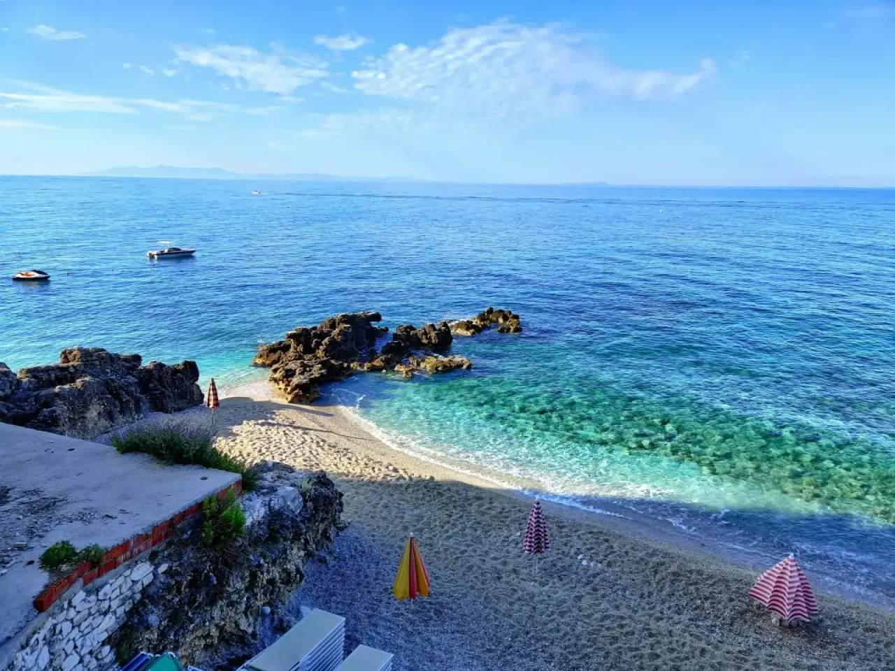
Google Maps will show a "road" leading to a remote beach -- Gjipe, Filikuri, or a cove south of Borsh -- and route you there as if you can drive. In reality, many of these are hiking trails, goat paths, or tracks requiring a 4x4.
The access to Gjipe Beach, for example, involves a steep gravel descent that rental cars cannot handle. Google Maps routes you to the trailhead but does not mention the last 2 km is a hike. The same applies to Filikuri Beach and other hidden coves. Cross-reference beach access with a dedicated guide or ask locally before driving down a road that narrows and loses its pavement.
Public Transport: Almost Zero Data
Google Maps has no public transport data for Albania. No bus routes, no departure times, no furgon schedules, no stop locations. The "transit" option is useless for planning a trip from Himara to Saranda or Tirana to Vlore.
For public transport along the Riviera, ask locally, check with your accommodation, or reference a dedicated guide to getting around Himara. Furgons (shared minivans) are a practical and cheap way to travel the coast, but they operate on informal schedules that no app tracks.
Business Hours and Seasonal Data
Google Maps listings for Albanian businesses frequently show incorrect hours. Many Riviera restaurants operate seasonally (May to October) and shift hours based on demand and weather. A place listed as "Open until 11 PM" might close at 9 PM on a slow Tuesday, or stay open past midnight in August. Do not rely on Google Maps for current hours. Call ahead or walk past.
Missing Places
Albania's tourism infrastructure grows fast. New guesthouses, restaurants, and beach bars open every season, and many never make it onto Google Maps. Smaller family-run accommodations in villages like Qeparo, Palase, or upper Himara are often absent entirely. If Google Maps shows no restaurants in a village, that does not mean there are none.
Alternative Navigation Apps
No single app covers Albania perfectly, but combining two gives you solid coverage.
Maps.me
The best complement to Google Maps for Albania. Maps.me uses OpenStreetMap data, which is often more detailed than Google's coverage for Albanian trails, minor roads, and rural paths. Offline maps include walking trails, beach access paths, and small roads that Google ignores.
Best for: offline navigation, hiking trails, beach access routes, rural areas.
Organic Maps
An open-source fork of Maps.me with a cleaner interface and no ads. Same OpenStreetMap data, same offline capability. If you prefer privacy-focused apps, Organic Maps is the better choice. It includes hiking trail markings and contour lines useful for Riviera hikes.
Best for: hikers, privacy-conscious travelers, clean offline maps.
Waze
Growing user base in Albania, especially among locals. Waze is better than Google Maps for real-time road conditions -- construction, police checkpoints, road closures, and hazards reported by other drivers. Less useful for finding businesses or navigating on foot, but strong for driving.
Best for: real-time driving conditions, avoiding construction zones.
Which Combination to Use
For most Riviera travelers, Google Maps + Organic Maps (or Maps.me) covers nearly everything. Use Google Maps for restaurant searches, reviews, and main road navigation. Use Organic Maps for offline backup, trail navigation, and verifying rural routes.
Offline Maps: Not Optional
Download offline maps before you arrive in Albania. This is not a suggestion -- it is essential.
Cell coverage is fine in towns and along the SH8, but drops in mountains, tunnels, canyons like Gjipe, and isolated stretches of coast. If your signal drops mid-navigation, you need your map to keep working.
How to prepare:
- In Google Maps, search for "Albania," tap "Download," and save the entire country (~200-300 MB).
- In Organic Maps or Maps.me, download the Albania region. These files are smaller and include trail data.
- Do this on Wi-Fi before leaving home, or at your hotel in Tirana before heading to the coast.
Even with a local SIM card or eSIM (Saily is the easiest pre-trip option — see our connectivity guide), offline maps are essential insurance.
Albanian Riviera Navigation Tips
These are specific to the Riviera coast, where most travelers spend their time.
SH8 is well-mapped. The main highway from Vlore through Himara to Saranda is accurate on Google Maps. Trust the routing on this road. Do not trust the drive times.
Beach turnoffs need local knowledge. The SH8 passes above most beaches. The turnoffs are often unsigned or marked only with a small hand-painted sign. Google Maps will show the turnoff point, but it will not tell you the road quality. Ask at your hotel or rental agency about specific beach access before driving.
Satellite view is your friend. Before committing to any unfamiliar route, switch to satellite view and trace the road visually. Paved roads show as grey ribbons. Dirt tracks show as brown lines. If the road turns brown, think twice.
Do not trust "fastest route" blindly. Google Maps sometimes routes through mountain back roads to save 5 minutes on paper. On the Riviera, the "fastest" route can be the most stressful. Stick to the SH8 unless you have confirmed the alternative road is paved and in good condition.
Parking is another gap. Google Maps does not reliably show parking availability in Himara or other Riviera towns. In summer, parking near popular beaches fills early. Plan to arrive before 10 AM at popular spots or check the Himara parking guide for alternatives.
Cross-reference for rural drives. If your route leaves the main highway -- heading to a mountain village, a remote beach, or an inland attraction -- check the same route on Organic Maps or Maps.me. If one app shows a road and the other does not, treat the route with suspicion.
FAQ
Does Google Maps work offline in Albania?
Yes. You can download the Albania map for offline use in Google Maps. Offline mode gives you turn-by-turn navigation and basic search, but you lose real-time traffic, business hours, and reviews. Download the map before you leave home or while you have Wi-Fi.
Is Google Maps accurate for driving from Tirana to Himara?
The route is accurate. The drive time is not. Google Maps shows roughly 4 to 4.5 hours. In practice, expect 5 to 6 hours depending on traffic leaving Tirana, construction near Vlore, and your pace over Llogara Pass. Add more if you stop at viewpoints.
Can I use Google Maps for public transport in Albania?
No. Google Maps has almost no public transport data for Albania. You will not find bus routes, furgon schedules, or stop locations. For public transport along the Riviera, ask locally or check dedicated transport guides.
What is the best offline map app for Albania?
Organic Maps or Maps.me. Both use OpenStreetMap data, which is more detailed than Google's coverage for Albanian trails and rural roads. Organic Maps is open-source and ad-free. Maps.me has a slightly larger feature set. Either one is a strong offline companion to Google Maps.
Does Waze work in Albania?
Yes. Waze has a growing user base in Albania, particularly around Tirana and on main highways. It is useful for real-time hazard reports, speed traps, and construction updates. Coverage is thinner on the Riviera than in Tirana, but still worth having for road trips.
Should I download maps before arriving in Albania?
Absolutely. Cell coverage drops in mountains, tunnels, and remote coastal areas. Download Google Maps offline data plus Organic Maps or Maps.me for Albania before your trip. Total download size is under 500 MB for both apps combined. This is the single most useful preparation step for navigating the Albanian Riviera.