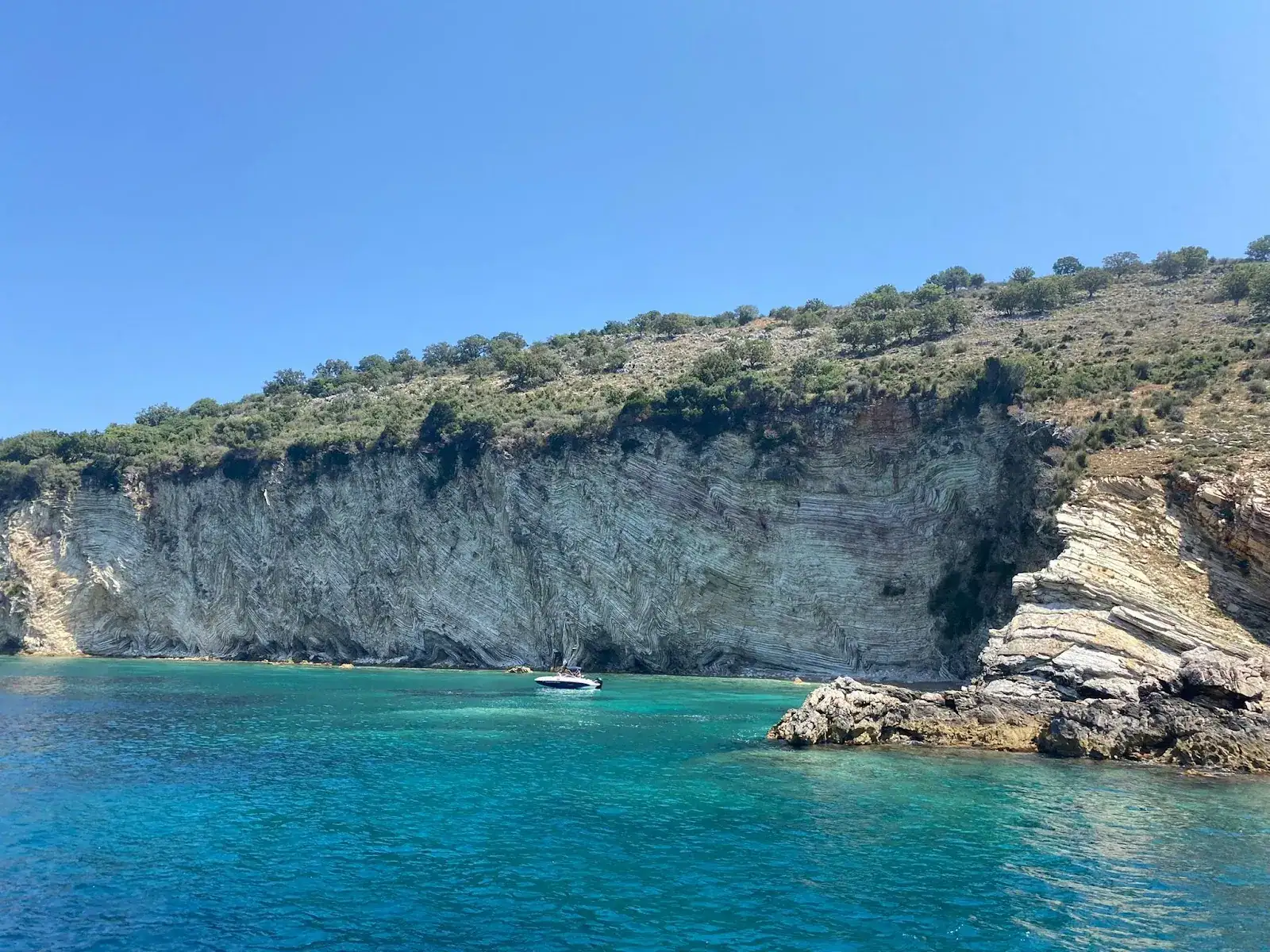
Folded grey limestone cliff at the Cape of Qefali, its rock layers bent into tight zig-zags above turquoise water with a small boat anchored below
peninsula

Cape of Qefali

Ook: Kepi i Qefalit · Cape Qefali · Kepi Qefalit · Gremina e Qefalit

Richting vanaf Himara
Zuidwaarts
Afstand over zee
About 25 km south of Himara in a straight line; roughly 11 km north-west of Saranda
Zwemstop
15-20 minutes at Gremina on group speedboat tours
Toegang
By boat. There is no road to the cape or to Gremina cove

Kepi i Qefalit is the folded-limestone headland on the Lukove coast, with Gremina cove tucked into it. A boat-only swim stop on the Saranda circuit past Kakome and Kroreza.

What the Cape of Qefali Is

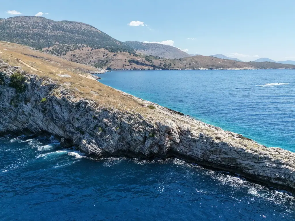
Kepi i Qefalit is a limestone headland on the Lukovë coast, the last big point before the shore turns toward Saranda. What people come for is the rock: the beds are folded into tight zig-zags across the cliff face, grey and white against water that goes turquoise over the shallow shelf at the base. It sits inside Himara municipality, at the far southern end of the coast this guide covers.

Gremina

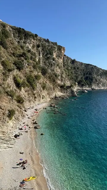
Gremina is the cove cut into the cape, and it is the reason the cape is on a tour itinerary at all. Operators describe a white-pebble shore under the cliffs with nothing built on it — no road, no bar, no sunbeds — and clear water that snorkels well over the rock.

  • Stops are short: 15 to 20 minutes on group speedboat tours, long enough for a swim off the boat
  • Some boats anchor off rather than land, so ask before you book if getting ashore matters
  • There is no shade and nowhere to buy anything. Bring water

Where It Sits on the Saranda Circuit

The cape is one stop on the standard speedboat run out of Saranda port. A typical route:

  1. Turtle Cave — a photo stop; one operator puts it about 1.5 nautical miles west of the cape and does not take boats inside
  2. Anchor Bay — short swim stop
  3. Gremina, on the cape — 15 to 20 minutes
  4. Kakome — the sheltered bay with the pier
  5. Kroreza — the long stop, two to three hours

Other Saranda operators sell a longer list that adds Soldier's Bay (Gjiri i Ushtarit), Rrojdhes Bay and Pllakoto. None of those three has its own listing on Google Maps, so we cannot give you a pin for them; treat them as names on an itinerary rather than places you can look up.

Getting There

There is no land route. The cape and Gremina are sold from Saranda, not from Himara, and the run is a speedboat circuit of four to six hours leaving the promenade mid-morning. From Himara the practical options are to drive to Saranda and join a boat there, or to charter privately and run south.

Coming at it from the Saranda side? Compare the group cruises, speedboat circuits and private charters in our Saranda boat tours guide before you buy on the promenade.

Strandsamenstelling

White pebbles in Gremina cove; bare rock along the rest of the headland

Water

Turquoise over the shallow shelf, dropping to deep blue off the point

Beste tijd

Morning, before the Saranda day boats reach this stretch

Ideaal voor

SnorkellingPhotographyShort swim stops

Locatie aan de Riviera

Doorgaans inbegrepen bij

  • Saranda speedboat circuits to Kakome and Kroreza
  • Private charters out of Saranda port

Boottochten die stoppen bij Cape of Qefali

Geen vaste route heeft Cape of Qefali als geplande stop.

Aanbieders in Himara kunnen het aan een privécharter toevoegen, of bekijk alles wat vanuit het dorp vertrekt.

Bekijk boottochten in Himara

Veelgestelde vragen

Where is the Cape of Qefali?+

It is the headland on the Lukove coast at 39.912°N, 19.909°E, inside Himara municipality, about 11 km north-west of Saranda and roughly 25 km south of Himara in a straight line. Google Maps lists it as a peninsula, with 4.8 from 9 reviews.

What is Gremina?+

Gremina, sometimes written Gremina e Qefalit, is the cove set into the cape. Operators describe a white-pebble shore below folded cliffs, reachable only from the sea. It is the stop the Saranda speedboat tours anchor at, typically for 15 to 20 minutes.

Can you drive to Gremina or the cape?+

No. There is no road down to either, and no marked path we could verify. Every operator that sells the stop arrives by boat.

Is Turtle Cave the same place?+

No, but it is on the same run. One Saranda operator places Turtle Cave roughly 1.5 nautical miles west of the cape and sells it as a five-minute photo stop with no swimming, because boats do not go inside.

Which tours stop here?+

The Saranda speedboat circuits. A typical route runs Turtle Cave, Anchor Bay, Gremina, Kakome and then a long stop at Kroreza; some operators also list Soldier's Bay, Rrojdhes Bay and Pllakoto. The big double-decker cruises out of Saranda usually skip the coves and park at Kakome and Kroreza instead.